A stormy history
The number of severe hurricanes in recent years may be normal, it turns out.
In the past few years, hurricanes such as Charlie, Frances, and Katrina have brought destruction and heartache to the southeastern United States. They are part of a recent surge in storm activity in the area, and many scientists have been blaming climate change for the trend.
A new analysis, however, suggests that the number of severe hurricanes we’ve seen recently is normal. The current trend seems extreme only because there was an unusual dip in storm frequency in the 1970s and 1980s.
 |
|
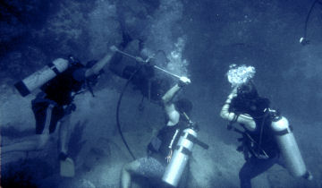
The researchers donned scuba-diving gear and drilled into underwater corals, which reveal hurricane history.
|
| Johan Nyberg |
Depending on its strength, a hurricane fits into one of five categories. Category 1 is the weakest. Category 5 is the strongest. Any hurricane that is category 3 or higher is considered highly dangerous. These storms deliver steady winds that travel at speeds exceeding 178 kilometers (111 miles) per hour.
Records show that between 1971 and 1994, an average of 1.5 category-3-or-higher hurricanes swept through the North Atlantic and Caribbean Oceans each year. Between 1995 and 2005, the number of such hurricanes in that area spiked to a yearly average of 4.1.
A hurricane’s strength depends on two main factors, says K. Halimeda Kilbourne, a paleoclimatologist with the National Oceanic and Atmospheric Administration in Boulder, Colo. One factor is wind shear, which describes adjacent layers of air that move at different speeds or in different directions. When wind shear is strong, tropical storms get ripped apart before they can develop into hurricanes.
The temperature of the ocean’s surface is the second major factor that influences hurricane strength. Rising sea-surface temperatures fuel the formation of stronger storms.
To explain the recent spike in hurricane frequency in North America, Kilbourne and her colleagues studied ocean records dating back to 1730. Among other types of evidence, they looked at coral, which form growth rings each year. Growth rings are bigger in years when more storms wash more organic material from the land into the sea. When wind shear is high, there are fewer storms and coral growth rings are smaller.
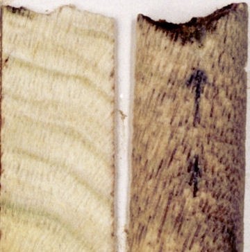 |
|
The scientists analyzed cross-sections of corals such as this one.
|
| Johan Nyberg |
After comparing coral data with a variety of other evidence, the scientists concluded that, in the North Atlantic, wind shear is more important than sea-surface temperature in determining how many strong hurricanes will form each year.
On average, the study showed, 3.25 category-3-or-stronger hurricanes formed in the region each year between 1730 and 2005. During that time, there were at least six periods of heavy hurricane activity, similar to what we’ve seen in recent years.
In general, the spikes in activity occurred when wind shear was weak. During periods when wind shear was strong, strong hurricanes tended to form less often. Some of these lulls happened even when sea-surface temperatures were higher than normal.
The new data might help scientists better predict and prepare for the next Katrina-like disaster.—Emily Sohn
Going Deeper:
Perkins, Sid. 2007. Storm norms: Caribbean corals and sediments yield clues to hurricane frequency. Science News 171(June 9):358. Available at http://www.sciencenews.org/articles/20070609/fob8.asp .
Sohn, Emily. 2005. Unnatural disasters. Science News for Kids (Sept. 21). Available at http://www.sciencenewsforkids.org/articles/20050921/Feature1.asp .
______. 2004. Recipe for a hurricane. Science News for Kids (Sept. 29). Available at http://www.sciencenewsforkids.org/articles/20040929/Feature1.asp .